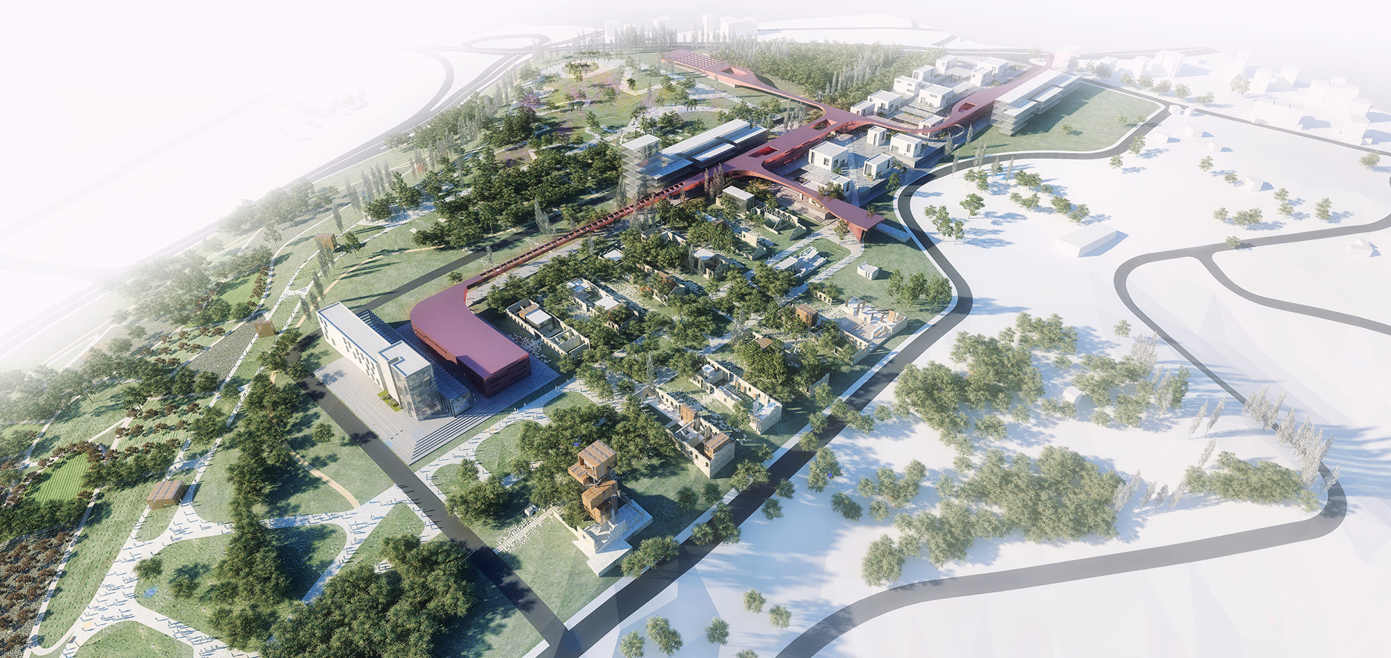
Bandırma Design Institute and Parks The proposal begins with an injection of urban landscape along the ridge of the site. This injection
exists as a platform on which new visitors can begin to interact with the site. The urban landscape is
characterized by a dense and diverse arrangement of program which will stimulate different facets of
society to interact and engage with each other. Focusing of the settlement is done on an area of the
hill with minimum tree coverage, thus preserving the ecological character of the hill as much as
possible. Freeing the rest of the site for recreational purposes also allows for visitors to appreciate
and explore a dramatic landscape that is littered with history and ruin.
Date: February 2017
Type: International Competition
Program: architecture, landscape, masterplan
Size: 260.000 m2
Client: Bandırma Municipality
Location: Balıkesir, Turkey
Status: Published
Demand: A new park for the future of the city
 1. Density + Diversity
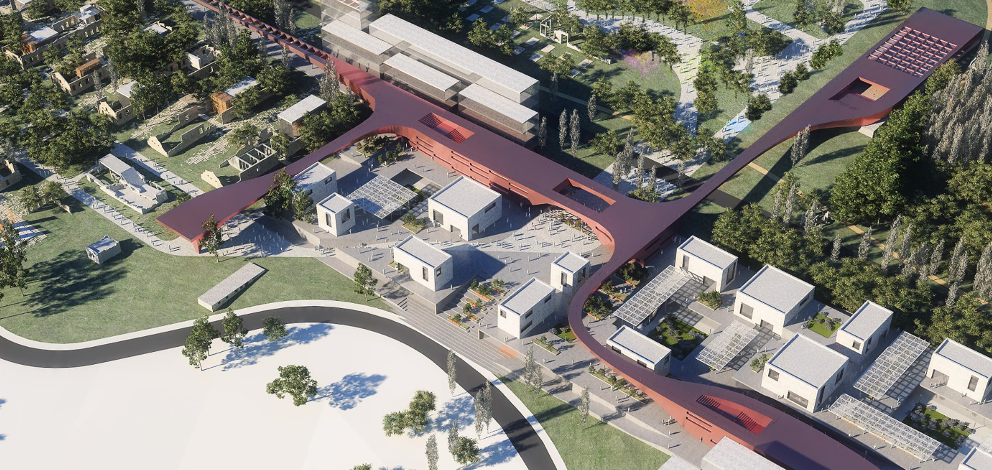
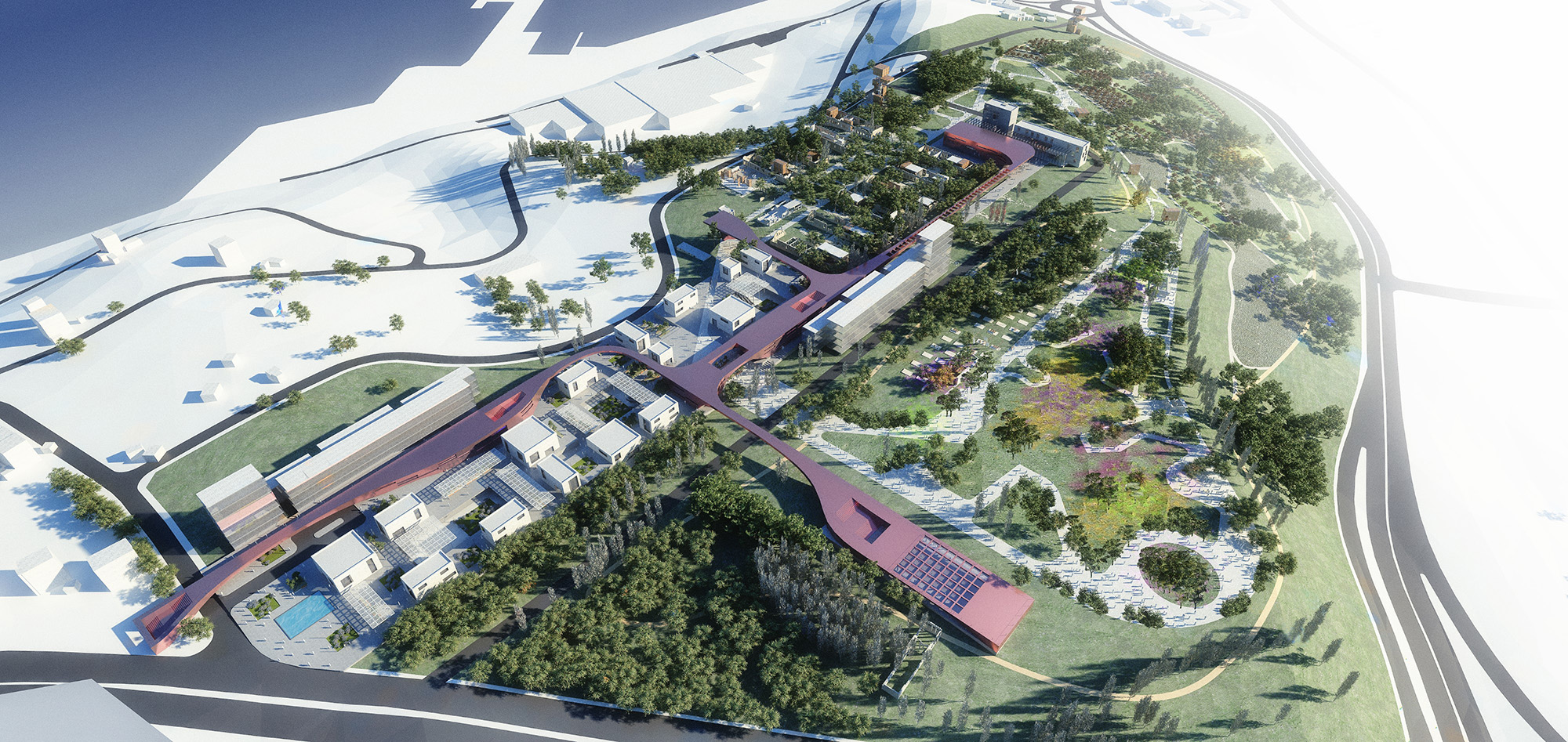
An urban plateau is inserted into the corner of the site. This location is ideal for settlement due to the
relatively flat topography which enhances walkability of the project. The urban plateau contains a
dense and diverse set of programs which are necessary for placemaking. While within these places,
there will be unobstructed views of the Marmara Sea without having to peak over the treeline to see
it. The tightness of the plateau keeps the buildable area to a minimum, reducing the environmental
impact on the hill.
 2. Access to the Plateau
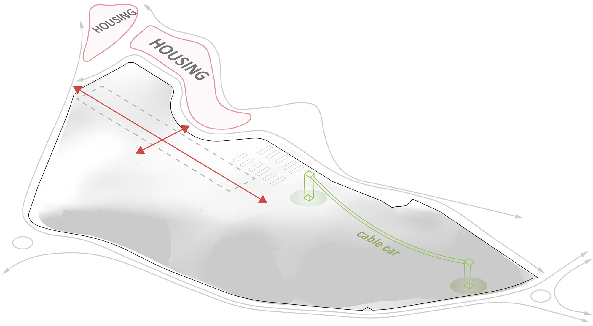
The site is located right on the edge of the city, being mostly surrounded by arterial roads that
connect Bandırma to İzmir and Erdek. We enhanced the circulation to the site by creating axial bonds
between the plateau and potential housing developments that border it. The relationship of the
plateau to the city is strengthened by adding an access road to the road network and connecting a
back road directly to an important roundabout at the bottom of the hill. A cable car link is proposed
to link potential pedestrian traffic from the city.
 3. Zoning in Loops
The plateau acts as a platform from which the rest of the site can be explored. The experiences on the
hill are layered by creating loops that overlap and intersect with each other. This is done to establish a
zoning hierarchy which visitors can travel through. The layers are arranged based on topographic
accessibility and their functions. Flatter areas tend to have more public functions, while steep areas
are dedicated singular paths.
 A. Cultural Enclave
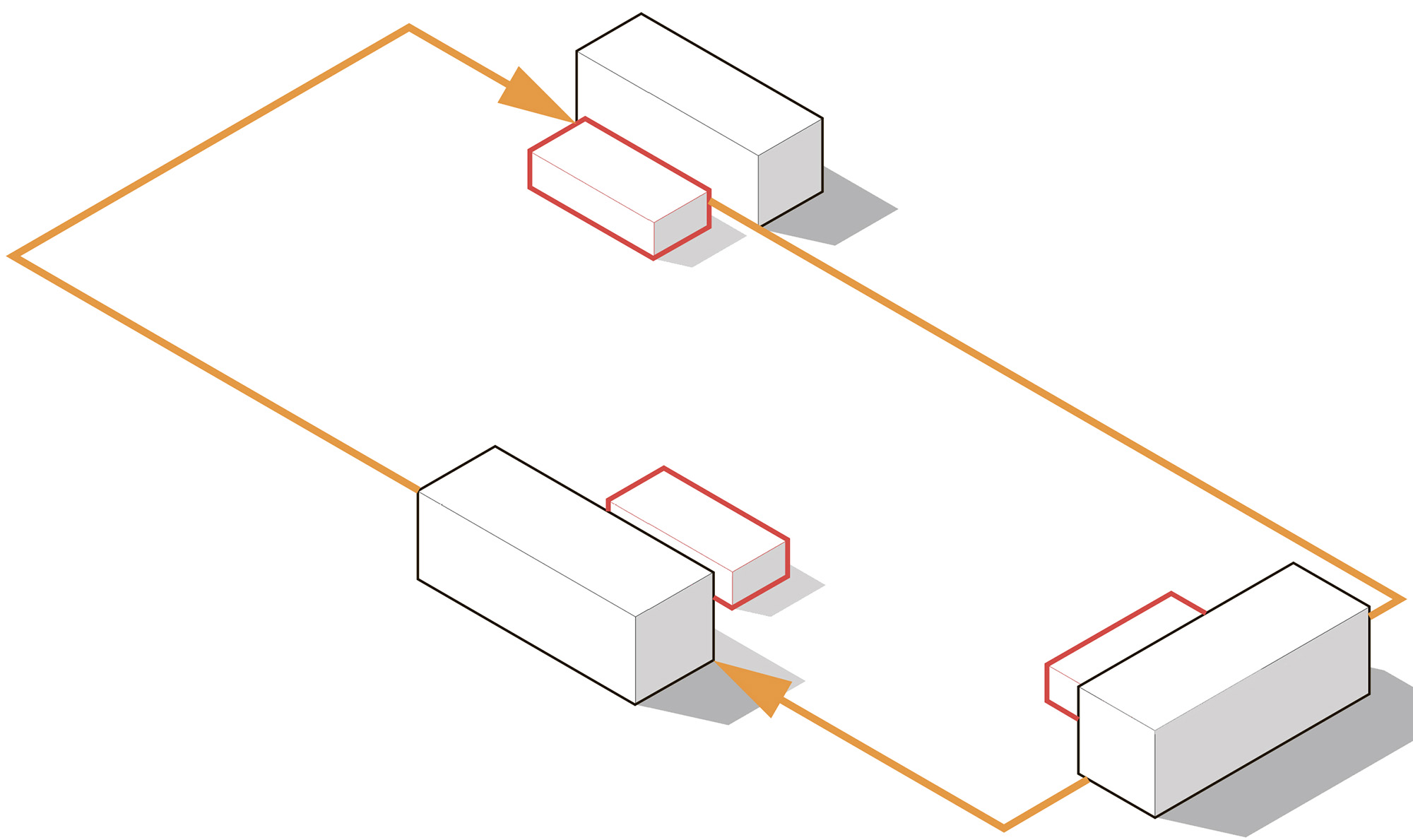
The plateau can be used as an organizational strategy for any program that is situated around it. 3
major programmatic elements are placed along the edges, with 3 minor complementary program
attached to them. Each of these pairs are connected by their functional relationships, creating a
circulation loop through them.
 B. Pavilions and Workshops
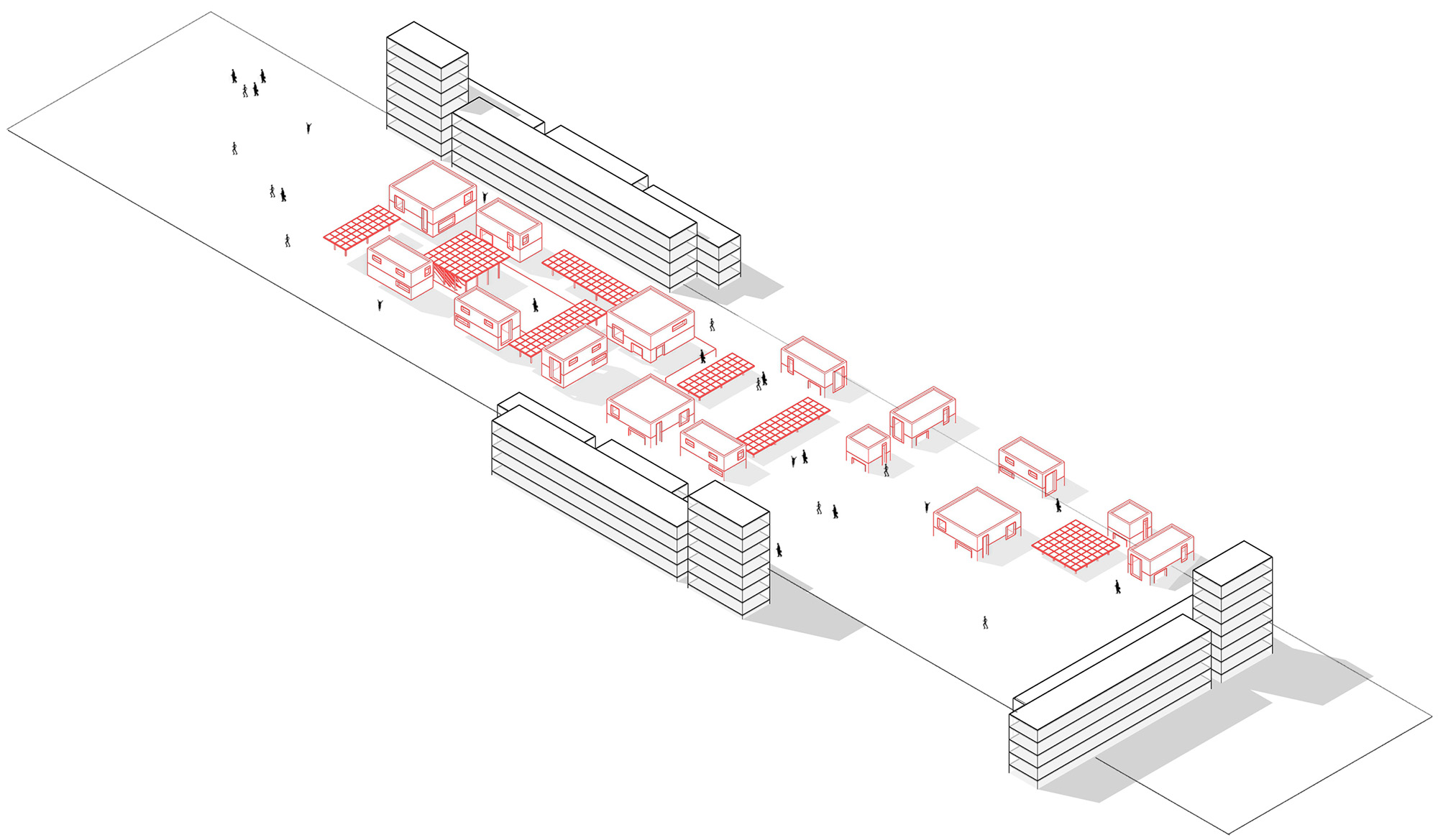
In between the pedestrian traffic and the major functions exist smaller and more flexible program
such as retail, design workshops, and exhibition spaces. This is done to create places at the human
scale, adding diversity to the plateau in both physicality and in function. In between spaces become
the meeting areas for the enclave.
 C. Connective Tissue
As an alternative to the in between spaces on the plateau, a connective tissue is developed to create
more direct modes of access from inside and outside the park. The tissue is flexible as it combines
canopies, walkable roofs, and anchor programs within one dynamic form. This is also done to
counteract the rigidity that exists on the plateau.
4. Landscape Concept
Landscape consists of overlapping layers strung out around the hill. Firstly, there is an active loop that
provides outdoor activity functions such as an amphitheater and a botanical garden, which connects
all other layers of landscape to it. For more intimate experience, a Nature Path meanders throughout
the pre-existing landscape, which act as buffer zones from the highway. The third is a Productive
Landscape that consists mainly of olive and fig trees along open ridge of the hill. Lastly, there is a
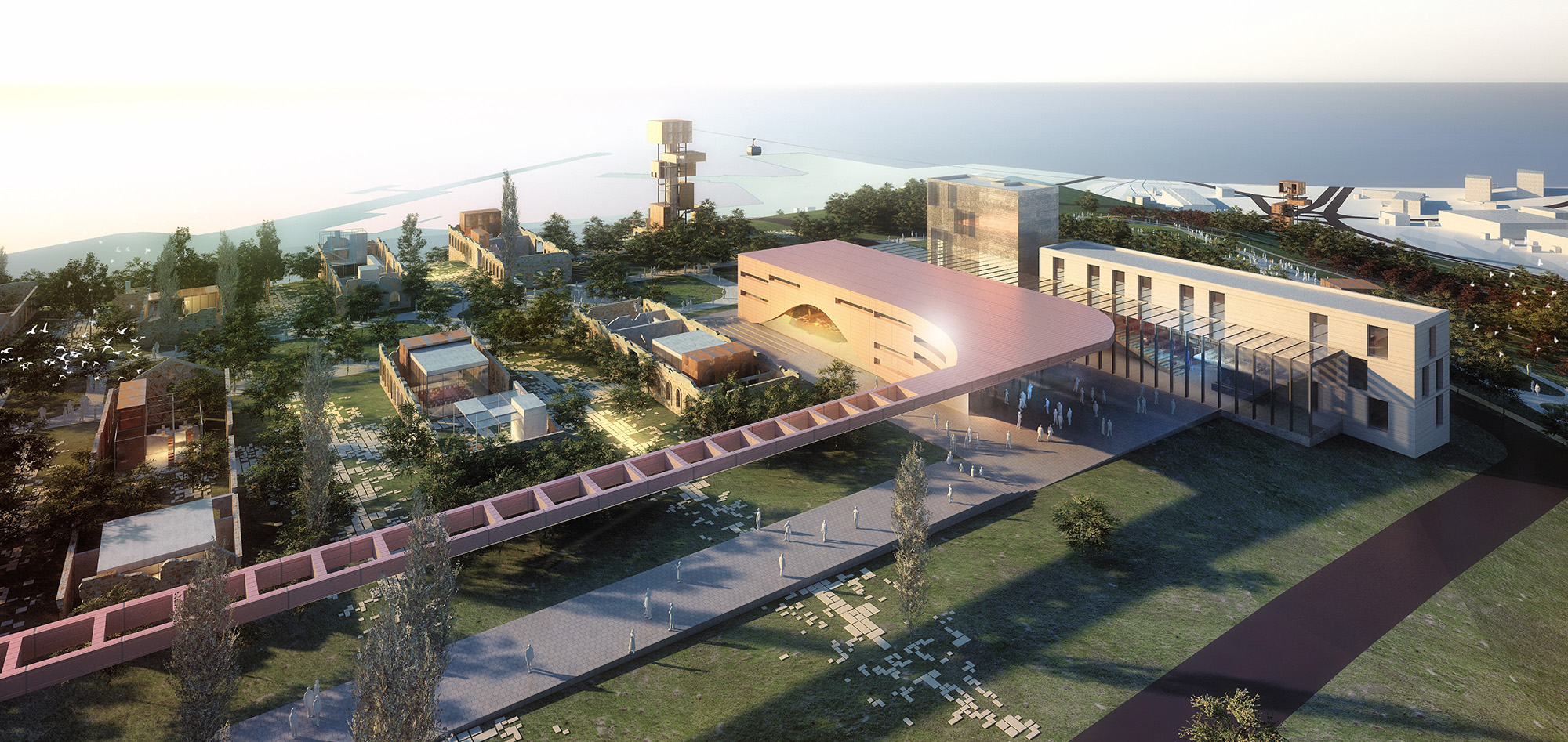
historical zone that activates the stone ruins on the site by placing within them pavilions, workshops,
and exhibition spaces that engages both visitors and people working at the design institute as well.
The historical zone is connected to the site by using a passive gradient stonescape.
5. Building / Architecture Analysis
Each major function follows a couple of basic design rules that start at the masterplan level and finish
at the human scale. The forms generated for the architecture is based on shifting masses that slide
along the periphery of the urban plateau. Each form consists of varying horizontal bars, with a vertical
bar at the end of each building. The bar gives hierarchy and directionality to the overall massing, but
also makes the overall project more visible from the city center. Paired next to these shifting blocks
exists a free flowing connective tissue that blends bridges, canopies, and buildings into a single form.
This fluid structure gives the masterplan a contrasting element to the boxes on the plateau, while also
connecting key points of the site both physically and visually.

