Adana Ziyapaşa City Center
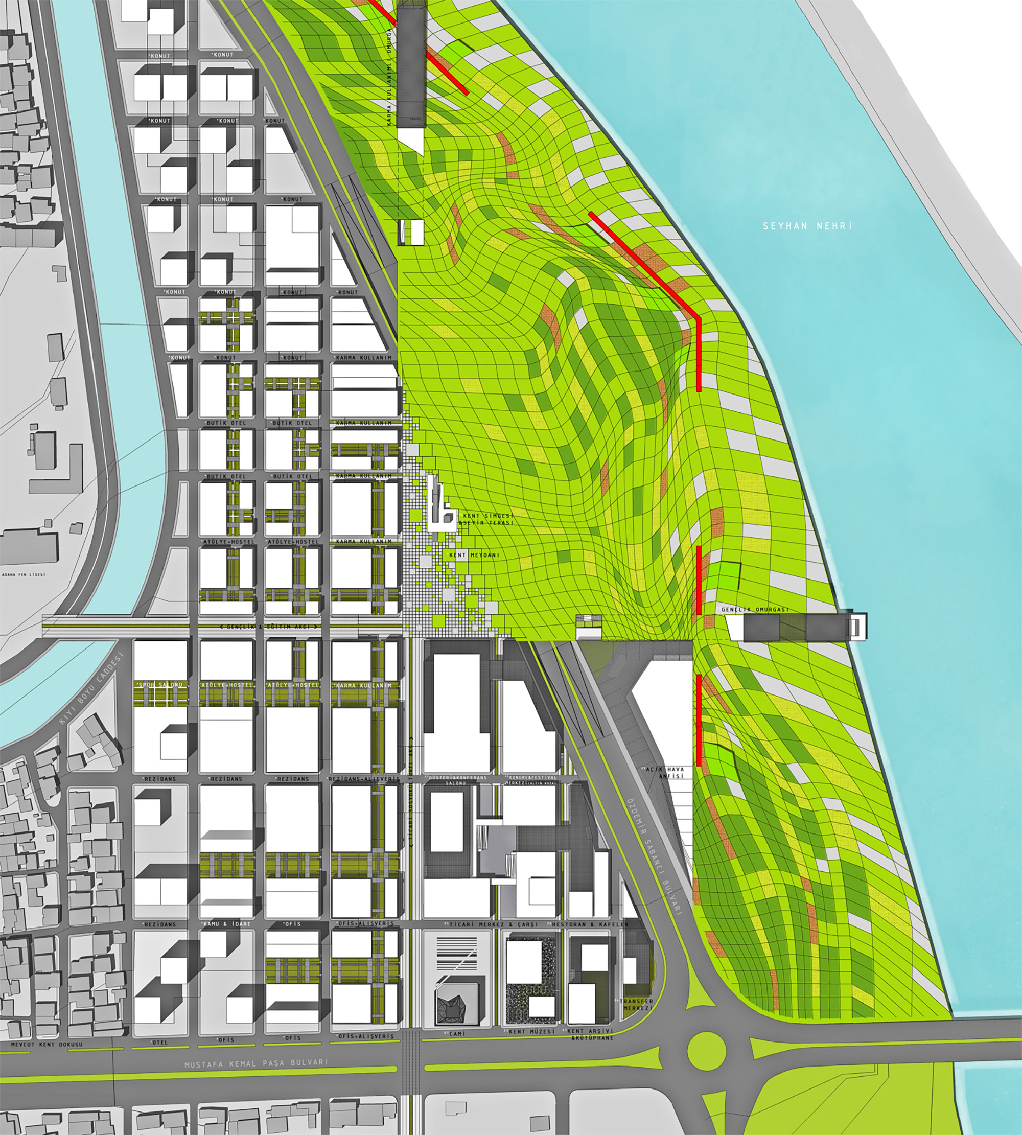
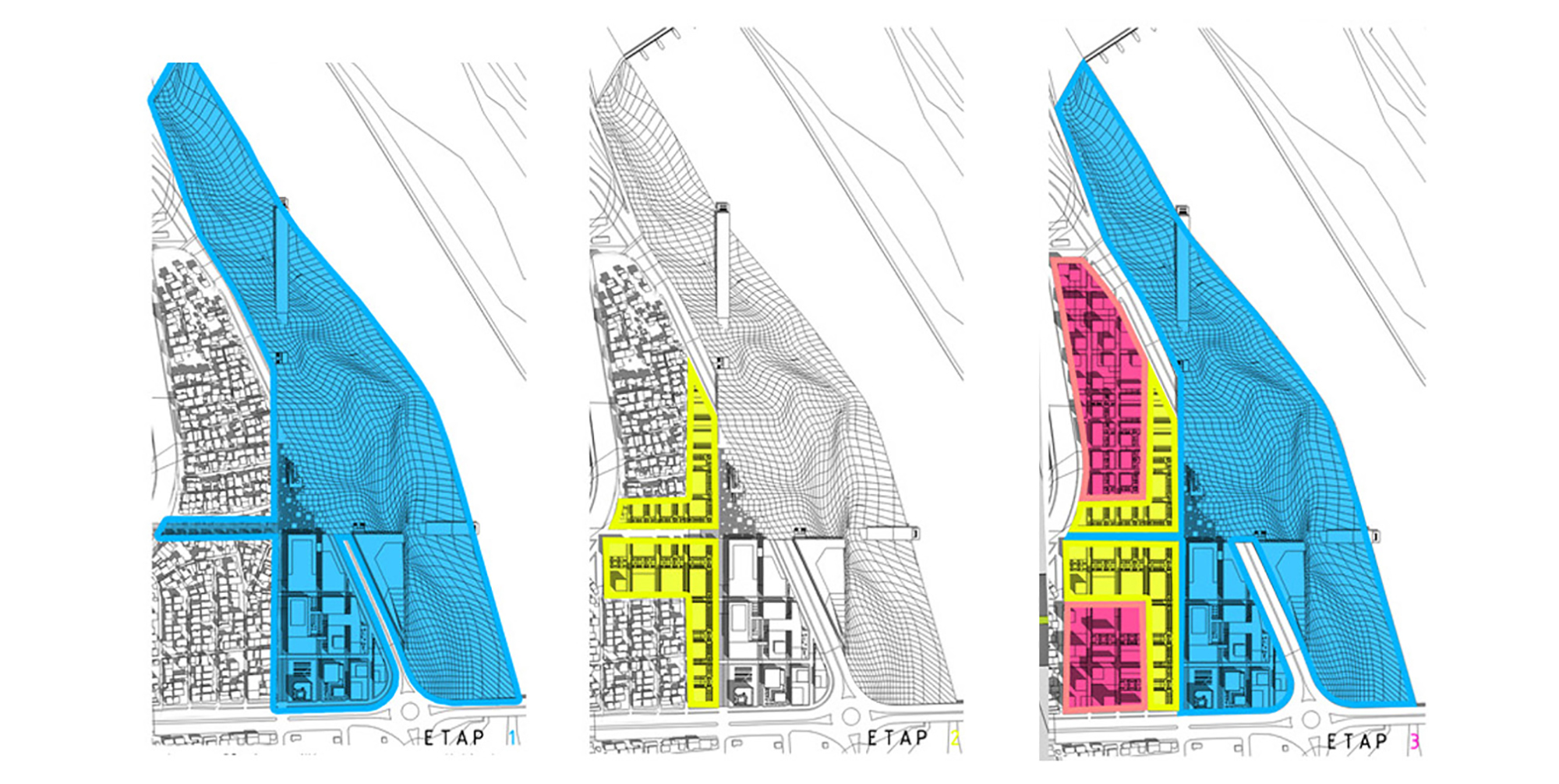
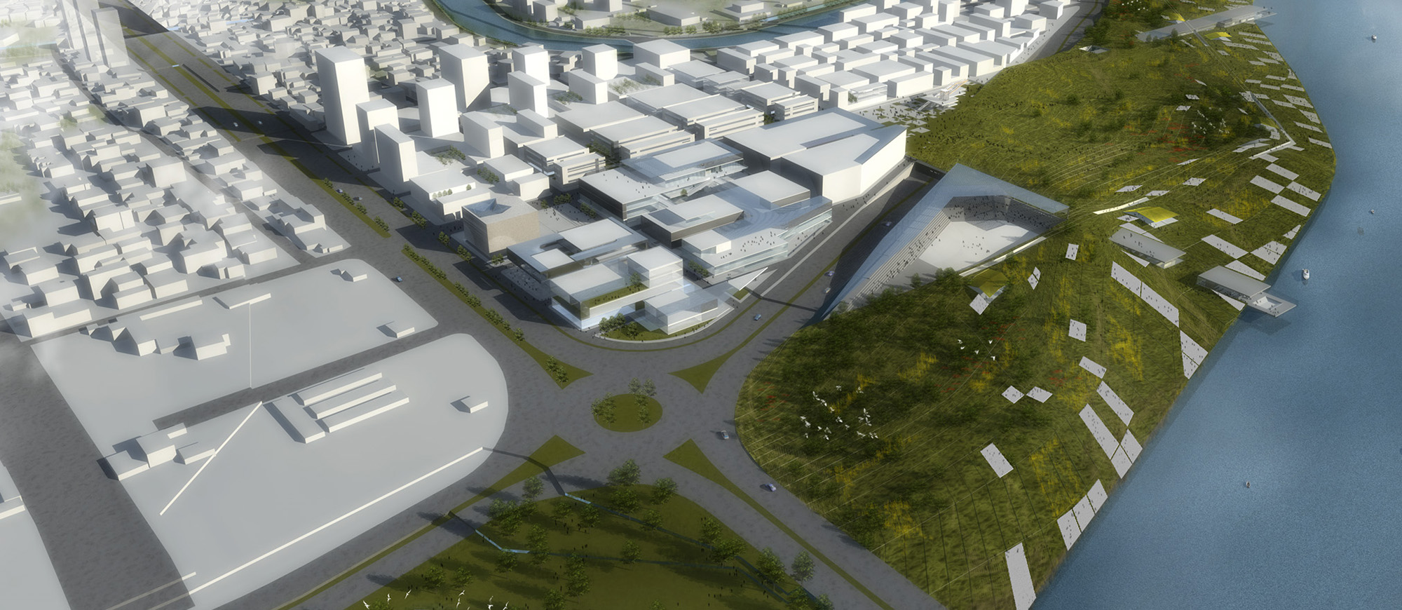
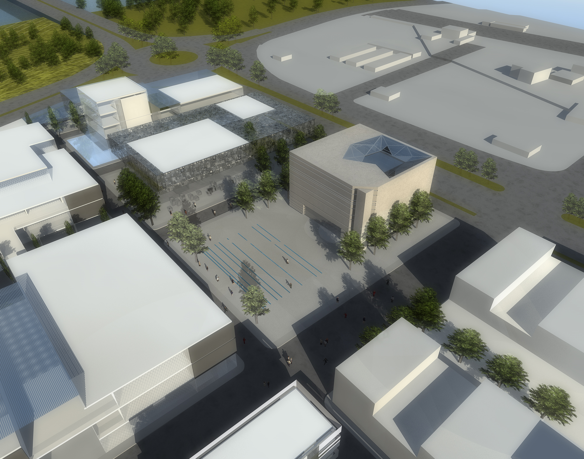
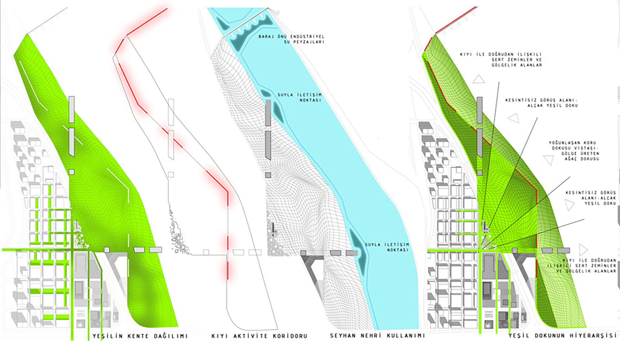
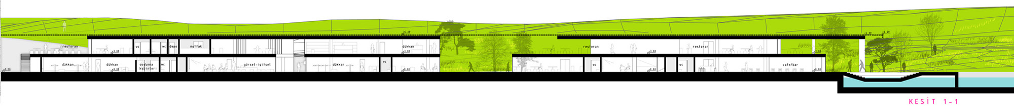
The Project brings the constructed and the natural environment together at the urban center. At this tense spot the intensity is foreseen to be changing both direction and phase. The city, starting from the urban center to the Seyhan River, melts away.The design of the urban part of the project, resulted with the rationalization and revision of the present transportation network -and therefore the city blocks-, is based on a flexible gridal system. This gridal system which starts to deteriorate at the junction point in the urban center, evolves to another setup by the coastline with the idea of using the topography actively to its own advantage.
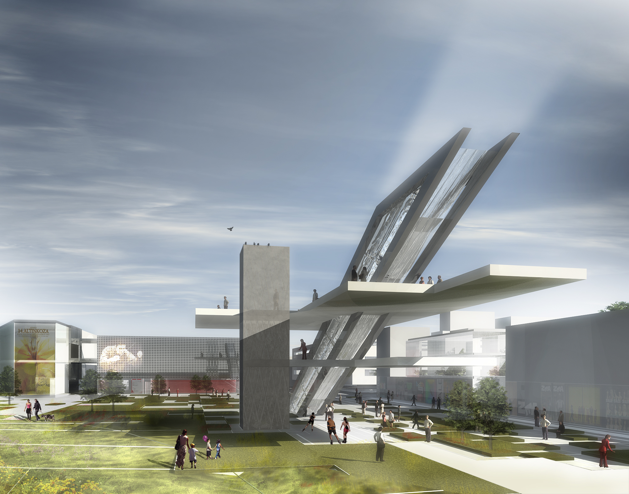
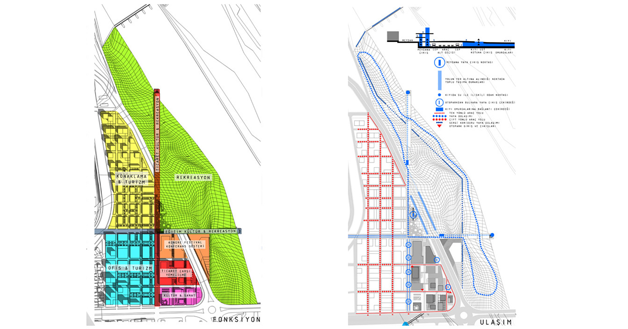
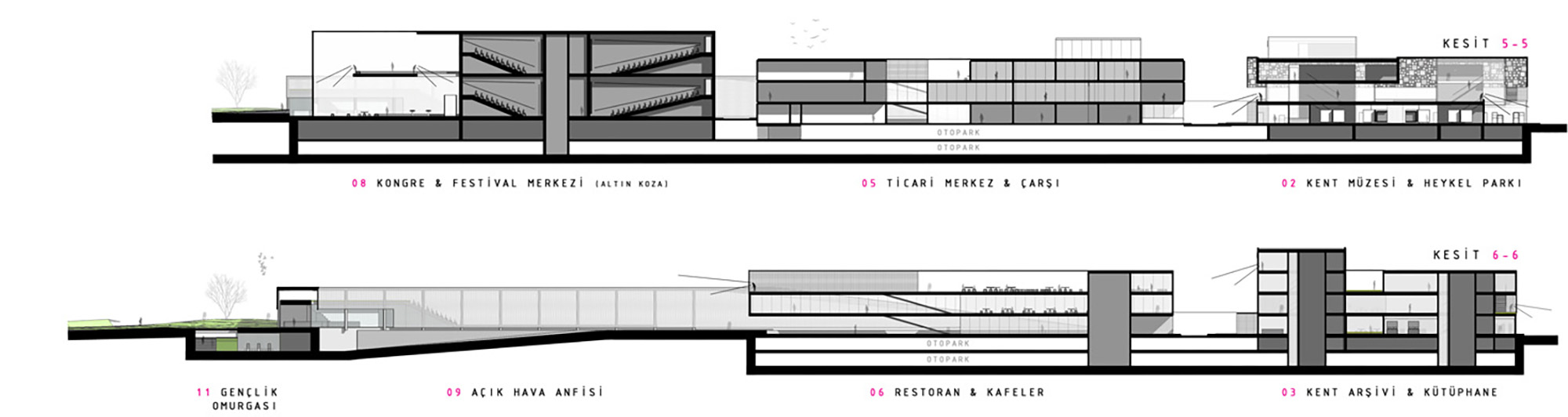
The 2 main pedestrian axis, perpendicular to each other, intersects at the urban center and become solid structures -headquarters of the activities throughout the coastline- as they lead their way to the Seyhan River. These activity spines' relationship with the coastal line occur sometimes as deeply hidden within the topography, other times over the topography leading underpasses, and finally as they put themselves into the Seyhan River and get in touch with it.
Date: February 2008
Type: National Competition
Program: Masterplan, Landscape
Size: 207.000 m²
Client: Adana Municipality
Team: Erhan Vural, Gökhan Kodalak, Ozan Özdilek, Çiğdem Karamürsel, Tuğçe Akbay
Location: Adana, Ziyapaşa, Turkey
Status: 2nd price
Demand: An urban center design project which is heavily feeded with new urban functions. the integration of the coast line to the urban center is also crucial.